
Project implementation: Brazil, Bolivia
Project development: Brazil, Bolivia
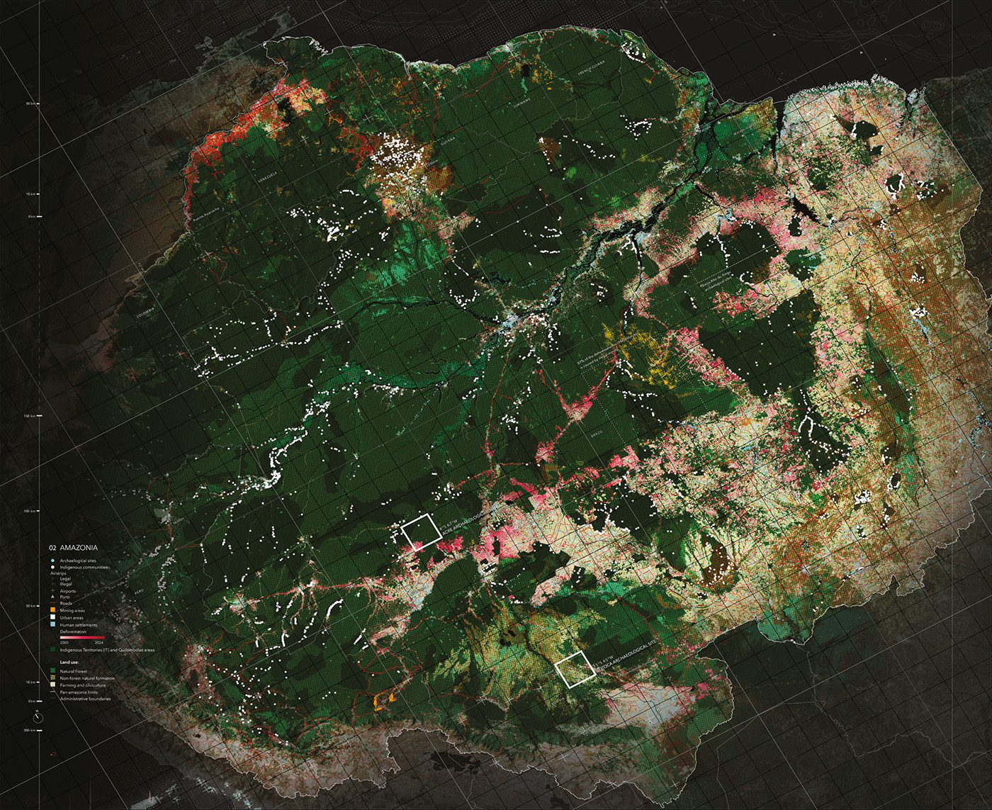
Forest Gens is a critical cartography project that reveals the extent of anthropogenic transformations in the Amazon. Using advanced mapping techniques in the Amazonian context, the project reveals the multiple layers that make up the region. From the footprint of current societies to territorial manipulations dating back centuries, the mapping presents the Amazon as a complex, human-shaped landscape, not as a homogeneous, untouched forest.
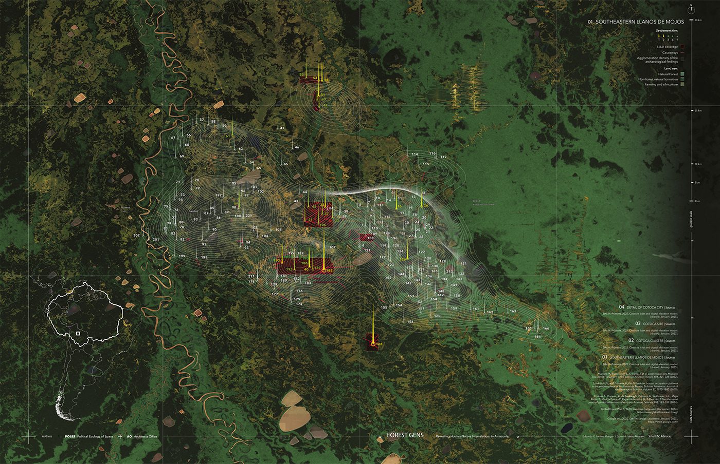
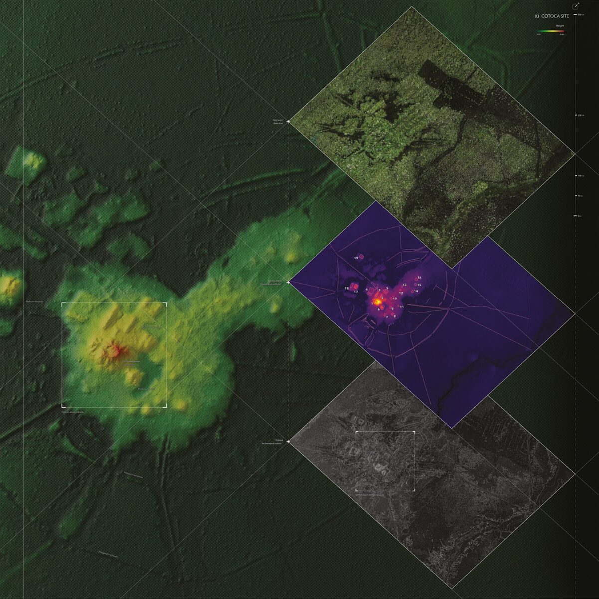
The work portrays the Amazon territory at multiple scales, highlighting how the interaction between geography and human interventions—past and present—allows for the development of hypotheses about the region's occupation. A focus on recent data obtained through remote sensing images in the Cotoca region of Bolivia reveals archaeological remains of ancient forms of low-density tropical urbanism. Similarly, a system of interconnected sites of indigenous black earth—organic residues of human occupation used to estimate the size and duration of ancient settlements—suggests prolonged manipulation of the Amazon environment by human societies.
Taken together, these visualizations contribute to raising awareness of the traces our ways of relating to this landscape have left throughout history, profoundly altering the boundaries between nature and society in this environment. The work is expected to contribute to the growing debate on how our societies can reinvent the relationship between urbanization and nature conservation, and imagine radically new—and less anthropocentric—futures for the Amazon.
Authorship
Concept: POLES | Political Ecology of Space
Collaboration: AO | Architects Office
Team:
Gabriel Kozlowski (Director)
Miguel Darcy
Carol Passos
Thiago Engers
Chiara Scotoni
Archaeological Research in Bolivia (Direction):
Heiko Prümers
Carla Jaimes Betancourt