
Project implementation: Brazil
Project development: Brazil
Department of Architecture and Urbanism – UFES. Special Projects II (ARQ 12226). 2025/01
This proposal is a partial result of the Special Projects II course (ARQ-12226) offered by the Department of Architecture and Urbanism at the Federal University of Espírito Santo (DAU-UFES). It is a continuation of academic studies and research by faculty and students that relate water to cities. The approach is that of architectural design for urban and regional river and maritime infrastructures, seeking to address the fundamentals of multiple water uses and the comprehensive utilization of river basins. The main object of study is the Doce River—an important basin in the Southeast Hydrographic Region—which has its contribution area in the states of Minas Gerais and Espírito Santo.
Historically, the Doce River valley was a route for penetration into the continent—as a natural waterway, its navigation was carried out along waterways, complemented by land routes along its banks. Successive human actions devastated the riverbanks, eliminating riparian forests and silting up the riverbed. This culminated in 2015 with the collapse of the Fundão dam in Mariana, Minas Gerais. This released mining waste into water bodies, contaminating the Doce River basin on a monumental scale. From Minas Gerais to Espírito Santo, a torrent of toxic mud reached Brazilian territorial waters, with impacts that are still being measured.
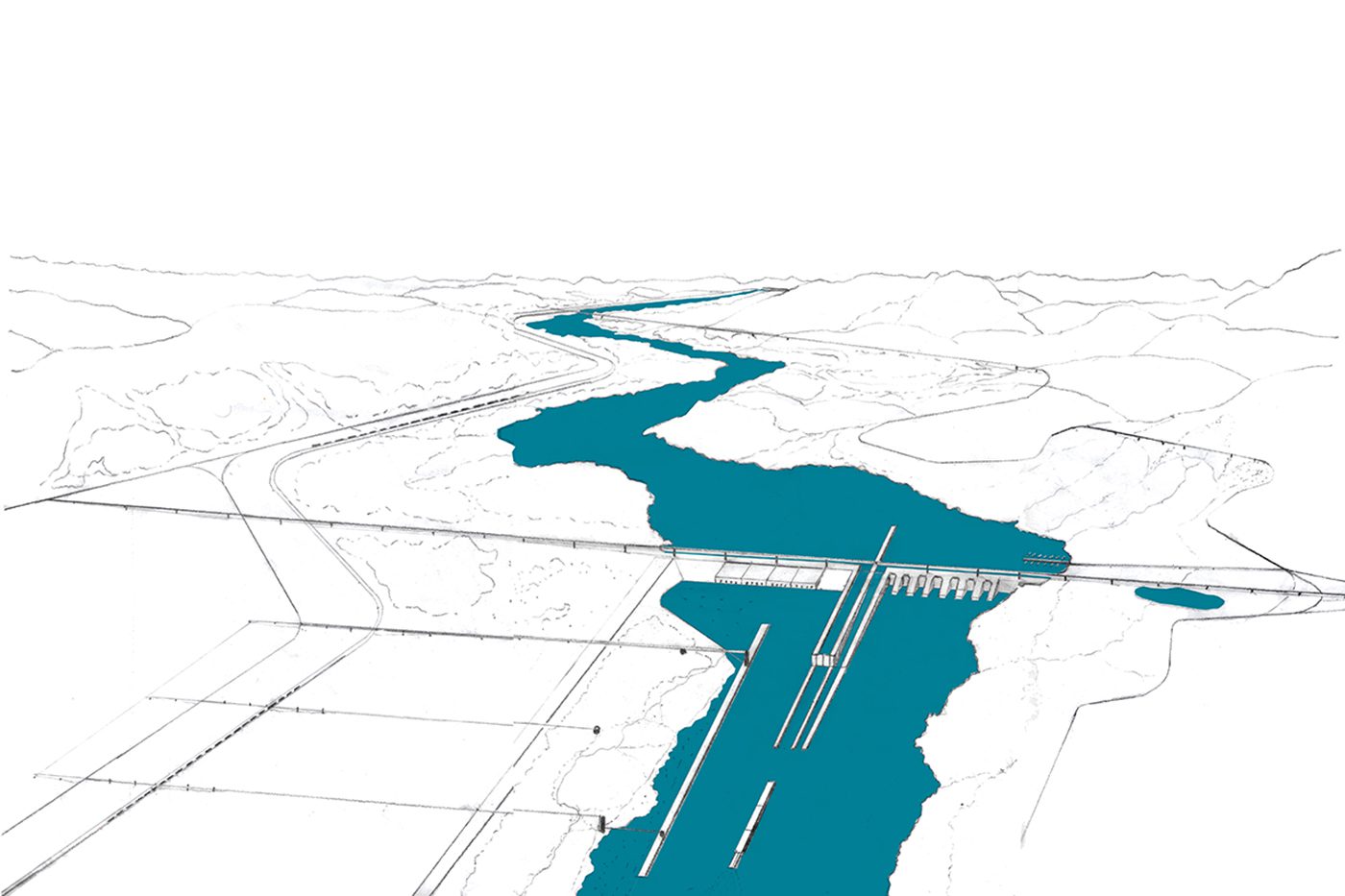
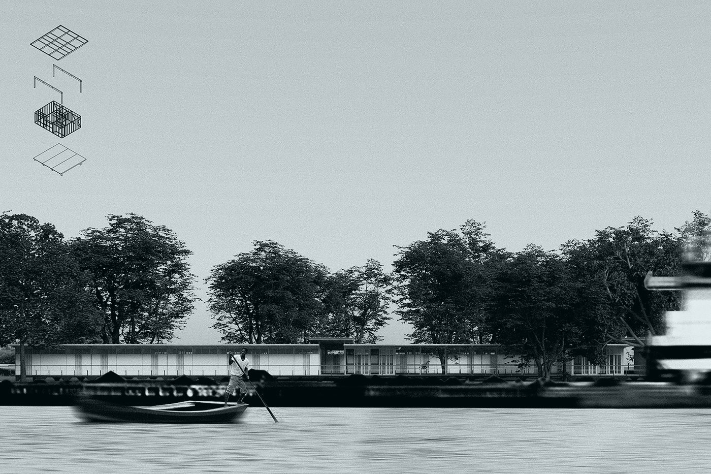
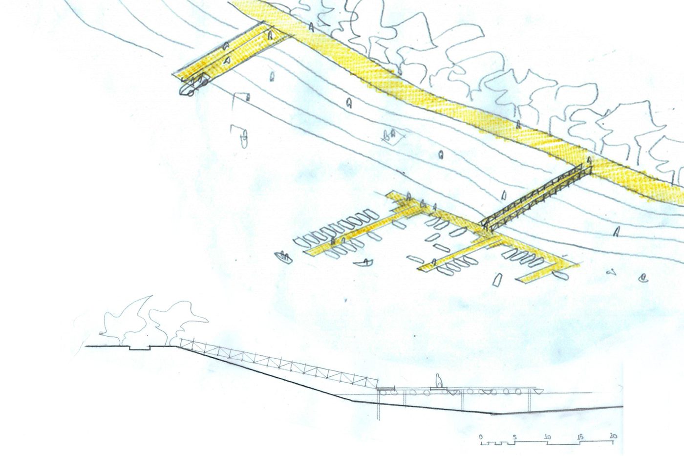
The proposed Rio Doce waterway encompasses the middle and lower reaches of the river, between Ipatinga (MG) and Regência (ES), connecting the Vale do Aço region to the seaports as a third transportation hub that connects to the Vitória-Minas Railway (EFVM) and the highways along the river's longitudinal slopes. The proposed main waterway is 444 km long and has a total water drop of 215 m from Ipatinga to the mouth. It features 35 Multiple Use Dams (MBDs)—32 new low-head dams and three existing dams spanned by lock ladders. The new dams—with maximum drop heights of 5 m—were designed to adapt to the urban and environmental scale of their surroundings, minimizing flooded areas along the banks and reducing the risk classification of the dams. In addition to navigation, the dams integrate functions such as low-cost power generation, environmental sanitation, riverbank connections, aquaculture/fishing, flood control, and drought relief. The main reservoirs will be complemented by feeder lakes on the tributaries, constituting an integrated infrastructure system for regulating year-round flow and recharging the basin's water resources. The flooded areas can also be used for public sustainable water use programs in positive partnerships with riverside communities. The waterway also opens up opportunities for environmental education, recreation, sports, and river tourism along the reforested banks, improving the coexistence of riverside communities.